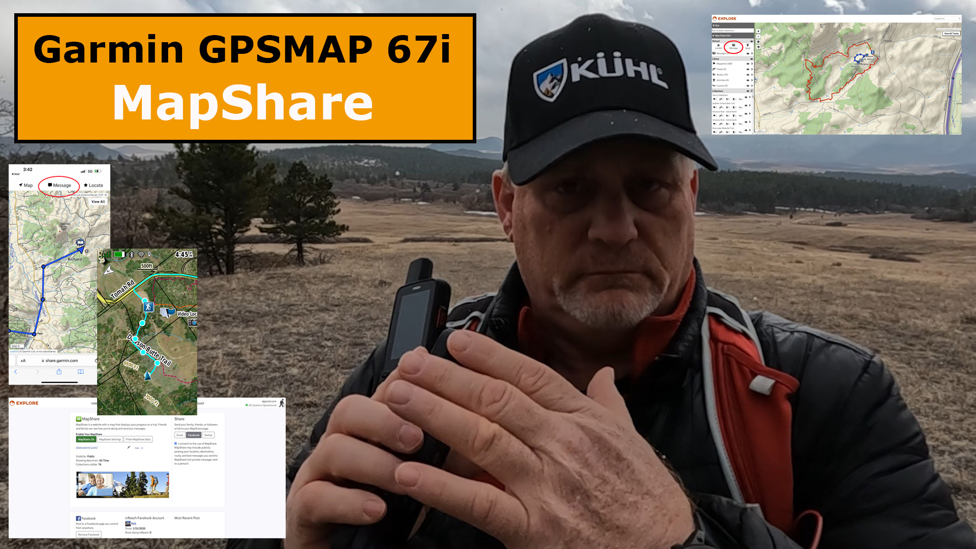
Here’s how you can communicate with Garmin GPSMAP 67i MapShare and Messaging.

Why is MapShare Important with the GPSMAP 67i
- Friends and Family can Keep Track of Your Location
- MapShare is the Only Way Someone Can Initiate a Message to You, Unless they Have Another inReach Satellite Communicator
MapShare Settings
You will need to go to your Explore.Garmin site and set everything up in advance of your trip in the Social tab.

In the Social tab, you will be able to change your settings, such as if you want to allow others to message you. Make sure you set this up first.

Once you have finished with your MapShare settings, you can select how and who you want to see your location within MapShare and who can message you.

Make sure you tell your family and friends what this is and how to use it.
Tracking & Messaging You on MapShare
The people you share your MapShare page with will get an email, and they will be able to see your location and initiate a message to you.


Your family and friends can also see the MapShare page and message you from their smartphone.

Final Thoughts
I know these tracks and messages will cost many of you money, depending on the subscription plan you have, but using MapShare can be extremely valuable.
If your concerned about spending a lot of money on MapShare, especially on a long trip, you can always change your subscription to Expedition for one month, where you will have unlimited tracking and messaging, than change it back afterwards.
Check out this YouTube Field Test video on the Garmin MapShare below.

- Large 3” sunlight-readable color display for easy viewing
- Enable two-way messaging and location tracking via the 100% global Iridium satellite network, and trigger an interactive SOS to Garmin Response℠, a 24/7 staffed emergency response coordination center (active subscription required; some jurisdictions regulate or prohibit the use of satellite communications devices)
- Access preloaded TopoActive mapping from Garmin, view satellite imagery, and navigate with multi-band GNSS support and sensors
- When paired with your compatible smartphone, you can access active weather forecasts and Geocaching Live
- Use with the Garmin Explore website or app on your compatible smartphone to help you plan trips and more
- Get access to a wide variety of premium mapping content delivered directly to your device via Wi-Fi technology with an Outdoor Maps+ subscription
This product was presentation was made with AAWP plugin.
Return to Home Page
![]()