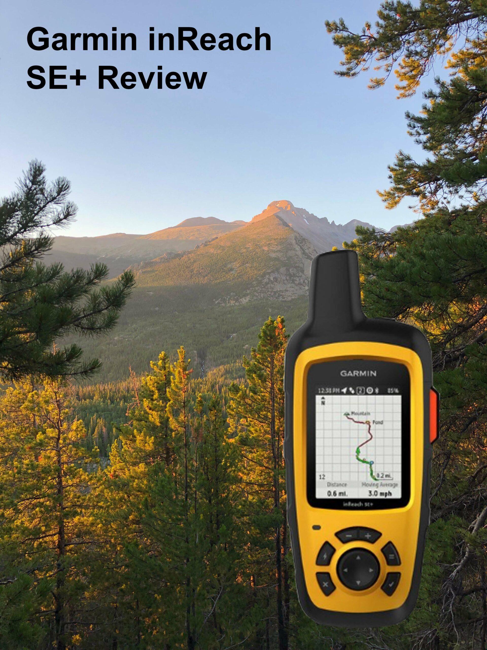
There is one Emergency Satellite Messenger that seems to stand out from the crowd and it’s the Garmin inReach Explorer.

Breakdown of what the Explorer Offers
- SOS Distress Call – 24/7 Rescue Monitoring Center
- 2-Way Messaging
- Built-In Navigation
- Pair with Compatible Mobile Devices
- 100% Global Pole to Pole Iridium Satellite Network
- Track & Share Your Location with Friends and Family
- Built-In Compass
- Barometric Altimeter & Accelerometer
- Weather Forecasts
- Unlimited Cloud Storage
- Built for the Backcountry
- Affordable, Flexible Satellite Airtime Plans
Let’s take a closer look into each of these incredible services.
SOS Distress Call
I have to put this one right at the top as a life-saving SOS call could change your life. Having this at your disposal, anytime, anywhere, from pole to pole cannot be over-stated.

You can trigger the INTERACTIVE SOS call to the 24/7 search and rescue monitoring center, located in Houston, Texas. GEOS has a long history of responding to emergencies worldwide. They have supported rescues in over 140 countries and they are standing by 24 hours a day, 365 days a year. GEOS will track your device and notify local SAR teams that are in your area. While help is on the way, they will continue to text back and forth with you, providing critical updates and you in turn can provide them with detailed information so they will have a better understanding of your situation when they arrive. No one thinks a life-threatening event will happen to them, but it does, and we should all be prepared for it.
Two-Way Messaging
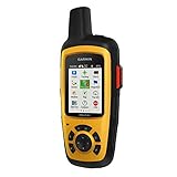
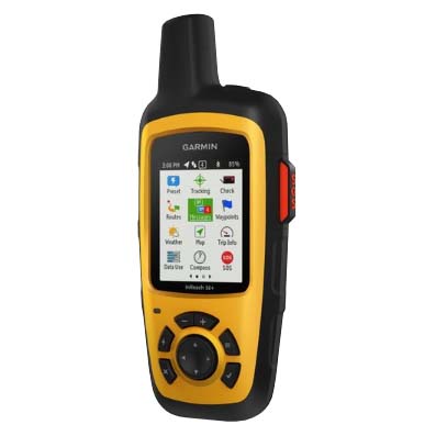
The Garmin inReach SE+ is a true Satellite Communicator which is better known as a Satellite Messenger.

No one wants to be fighting for their life in the wilderness, but if you were, wouldn’t you want to be able to text life-saving critical information to your family and friends?
What about non-life-threatening messaging? This will be dependent on if you want to be bothered when you’re on an adventure but the thought of being able to know if there was a critical emergency back home that you would want to cut short your trip for is invaluable. It goes the other way as well. There are many times that we have emergencies that are not life-threatening or at least not yet, and I personally would have liked to message someone for assistance several times.
You can exchange text messages with any cell phone or email address in the world. Your’re not in cell service, that’s not a problem due to the global iridium satellite network. You can message people anywhere as long as you have a view of the sky, plus you can share your journey with friends and even social media.
Built-In Navigation
I believe this is one of the subjects that many of you were waiting for.

Don’t know where you are or trails show up that were not there when you were planning your trip? With the Explorer in your pocket, you don’t have anything to worry about.
TOPO MAPS: This is something I need to research more as a route will show up on the screen, however, I don’t believe it will show topo maps on the device itself. I believe you can view topo maps when synced with your smartphone but I am about to buy the inReach SE+ and will then update this section after I field test it.
You can sync the inReach with your compatible Apple or Android device which makes text messaging even easier. The one thing your mobile phone can do a little quicker than the SE+ is, create new, unique text messages, and this is all possible when your are synced.
100% Global Iridium Satellite Network
This is a proven and reliable “pole to pole” network that actually covers the entire earth. If you are concerned about the coverage of some of the other models, then stop here and choose either the Garmin inReach SE+ or the Garmin inReach Mini 2. Both of them use this same network.

This is truly a tested and reliable network of satellites and 24/7 rescue monitoring center operated by GEOS. When you want to send or receive messages, navigate far from home or know that you SOS distress call will reach the right people, then this is the system you want on you.
This go-anywhere satellite messenger gives you all the luxury in the world, at least to an explorer, and you can rest assured that you can use your device anywhere you go.
- 100 percent global Iridium satellite coverage enables two-way text messaging from anywhere (satellite subscription required)
- Trigger an interactive SOS to the 24/7 search and rescue monitoring center
- Track and share your location with family and friends. Water rating : IPX7. Battery : Rechargeable internal lithium ion
- Pair with mobile devices using the free Earthmate app for access to downloadable maps, U.S. NOAA charts, color aerial imagery and more
- inReach SE+ device adds onscreen GPS routing plus built in digital compass, barometric altimeter and accelerometer
Check Amazon Price
Track and Share Your Location
You may not want to share everything but when you’re out away from people and any chance of service or rescue, your friends, family and even your social network can track your location and know you are doing fine.

Turn on your tracking service of your SE+ and you will be able to communicate with your friends and family by allowing them to follow your progress on their computer or mobile devices using the web-based MapShare portal. The Garmin inReach SE+ will send waypoints at pre-selected time intervals, so everyone can track your location online. You can also invite people back home to use MapShare to ping your inReach SE+ and see your GPS location, track your movements and exchange messages on your trip. You can even embed your MapShare page on a blog, website or social media site.
Built-In Compass and Barometric Altimeter
You may also like the added benefit of the built-in compass and barometric altimeter. I can’t tell you how many times I have wanted to know what altitude I was at. Not that it matters much, at least for me, but it is just something I am curious about.

The Garmin inReach SE+ has a built-in digital compass, barometric altimeter and accelerometer. In case you aren’t sure, an accelerometer measures acceleration, typically of an automobile, ship or aircraft.
Weather Forecasts
Would you be interested in checking in on the weather on extended trip, especially when it looks like things are going to turn for the worse?

The optional inReach weather forecast service provides detailed updates directly to your inReach SE+, compatible smartphone or tablet paired with the EarthMate app, so you’ll know what weather conditions to expect en route. Basic and premium weather packages are offered and you can request weather forecasts for your location or any other destination on your journey.
Unlimited Cloud Storage
The Garmin inReach SE+ comes with free access to a cloud-powered Garmin Explorer website to plan your trips with routes and waypoints. You can create preset messages and quick texts, sync and manage your device settings, update your firmware, download additional TOPO maps, link your social media accounts, store all of your location tracking data and more.
Built for the Backcountry

This is a tough and durable, impact resistant and water-rated to IPX7. The inReach SE+ handheld satellite messenger will keep you up and running no matter what mother nature throws at you. An internal rechargeable battery comes standard so you can count on long battery life in every mode of operation. The inReach SE+ can last 100 hours at a 10-minute tracking mode, which is the default setting, and up to 75 hours at 10-minute tracking with 1-second logging, and up to 30 days at the 30-minute interval power save mode. It can last up to 3 years when powered off. Recharge the SE+ via the standard micro USB power cable or optional in-vehicle 12 V charger.
Affordable, Flexible Satellite Airtime Plans
I can list the Satellite Subscription Plans for you here or you can see for yourself at Garmin’s Website. Just CLICK HERE for the four available plans.

As you can see, they have annual plans (paid monthly) starting at $11.95 and monthly plans (called FREEDOM PLAN) also paid monthly starting at $14.95.
My Final Thoughts
I have been on adventures my entire life and it has been only recently that I have given much thought to having a great SOS distress call, navigation, 2-way messaging, weather forecasts and so much more.
There have been many times I went out hiking or backpacking to get away from people, noise and technology but something has changed for me now. I still want to be left alone on a trip to the mountains but I also love to be able to navigate when I need to or request a weather forecast when the skies start turning ominous.

The Garmin inReach SE+ really is one of the best satellite messengers on the market. This is something that we should all have in our packs when venturing out on an expedition.
Please Email Me with your questions or thoughts on the Garmin inReach SE+ Review or Leave a Comment Below.
You can also explore more Satellite Messengers models HERE or Personal Locator Beacons (PLBs) HERE.
- 100% Global Iridium satellite coverage enables two-way text messaging from anywhere (satellite subscription required)
- Trigger an interactive SOS to the 24/7 search and rescue monitoring center
- Track and share your location with Family and friends. Display type: transflective color TFT
- Pair with mobile devices using the free Earth mate app for access to downloadable maps, U. S. Noaa charts, color aerial imagery and more
This product was presentation was made with AAWP plugin.
If you would like to see all the Satellite Messengers in another review, see my Emergency Radio Reviews.
Return to Home Page
No products found.
![]()
Garmin inReach SE+
Pros
- Two-way Messaging
- Built-in Navigation
- Global Satellite Network
- Weather Forecasts
- Tracking and Sharing
Cons
- Size & Weight
- On-Screen Topo Maps