This is the beginning of the training playlist for the Natural Atlas App Review, including a deep dive into every aspect of this cool nature app.
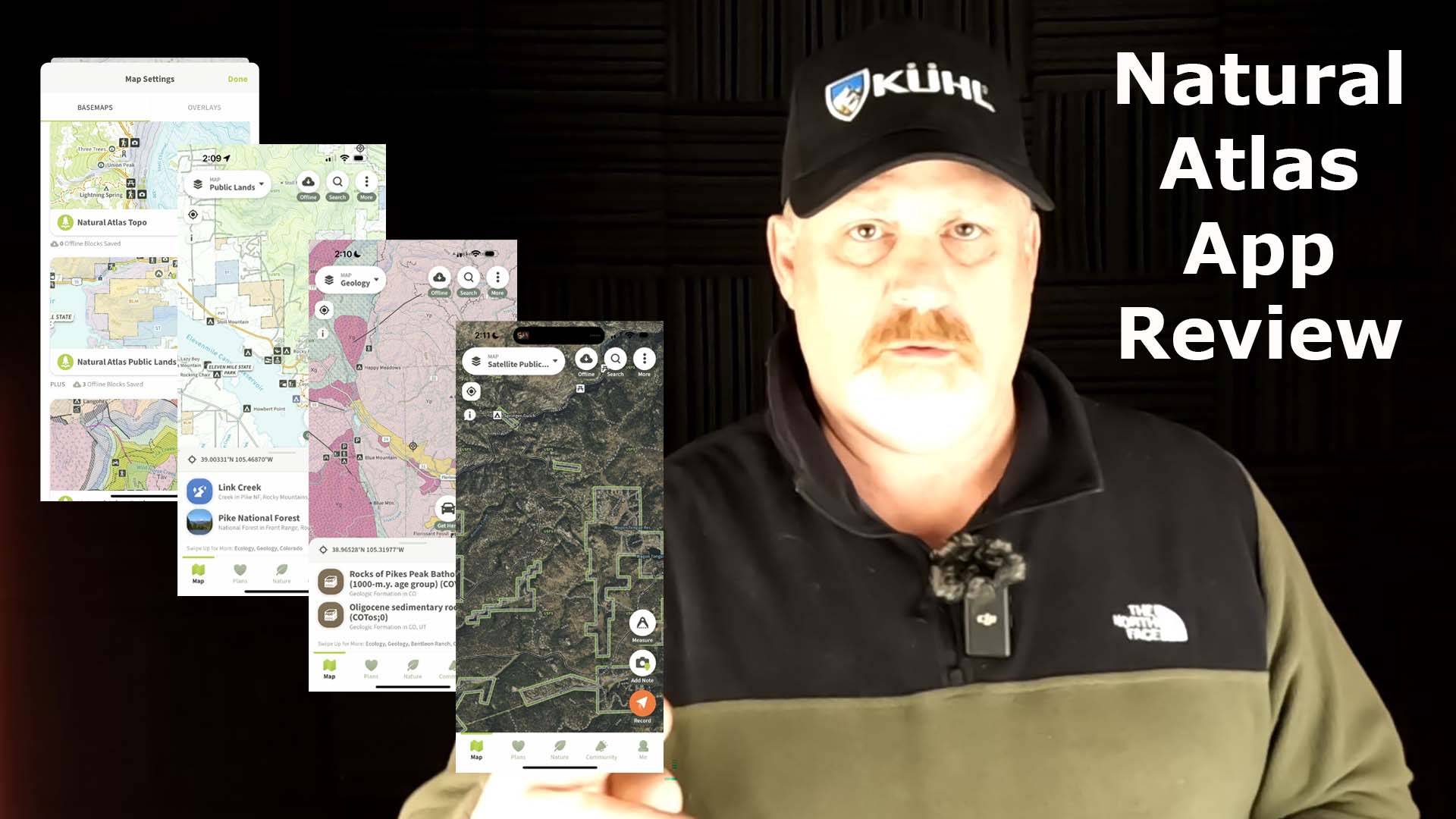
I recently started using the Natural Atlas App and initially I have been the most impressed by how easy it is to use their maps, and having the Public Lands map right at my fingertips, but before we get into that, let me list many of the things the Natural Atlas App will do.
Natural Atlas Features
 Hiking Trails
- Nature Guide
- Field Recorder
- Chronicle Your Discoveries
- Uses GPS to Locate
- Plants
- Animals
- Fungi
- Geology
- Light
- Tides
- River Levels, and More
- Navigate to
- 11,000+ Campgrounds
- 359,000+ Miles of Trails
- 46,600+ Miles of Historic Routes

- 23,000+ Boat Ramps
- Natural Features
- Multiple Maps to Choose From
- Natural Atlas Topo
- Natural Atlas Public Lands
- Natural Atlas Geology
- Global Topo
- Natural Atlas Satellite Topo
- Natural Atlas Satellite Public Lands
- NAIP
- Track Hikes and Note Your Discoveries
- Start Recording
- Search for Interesting Details
- Take Field Notes
- Classify Your Findings
- Build Your Atlas so You Can Look Back on Your Trip or Share with Friends
- Flexible Subscription Plans
You can tell from this extensive list that the Natural Atlas App is extremely powerful and is great for sharing with your friends and family.
My Favorite Things about Natural Atlas
As I started looking into the Natural Atlas App, I noticed the incredible maps and the convenience of the Public Lands maps. There are two of them, with one being a satellite image. Checkout these screenshots below.

There are so many times Mike and I, from MikenRickOutdoors are out on one of our Outdoor adventures and we’re trying to find a rural camping site on public land.

Here is one particular area we have camped several times and found that having a Public Lands map would have been beneficial.

You can see on the map to the left up top, that there is great information but no public land boundaries. You can’t see the public land boundaries on the right, but if you zoomed out, you would see them, however, when you select a point on the map, you will see it is Coal Mine Park in the Rio Grande National Forest.
This next example was really important to keep Mike and I from getting a hefty fine on the San Juan River. We were new to trout fishing here in Colorado, but soon found out more about what was private and public.

Again, you can’t tell from the map on the left in the above screenshot what was private or public, but from the map on the right, you can see it’s all a combination of private land and Bureau of Indian Affairs (BIA) land, and both of these are illegal to fish on, no matter if there are pull off along the river.
Final Thoughts
I do a lot of hiking and fishing around Colorado and some hunting so it’s always extremely important to me to keep a satellite communicator with me in case I need help or need to message someone, but it’s nearly as important to understand what is private land and public land.
I love this feature of the Natural Atlas App.
I have a lot more video reviews I will be uploading in the coming weeks and months, but so far, the Natural Atlas App is a winner for me.
Checkout the first Natural Atlas video in this new YouTube playlist in the video below.
No products found.
No products found.
Return to Home Page
![]()