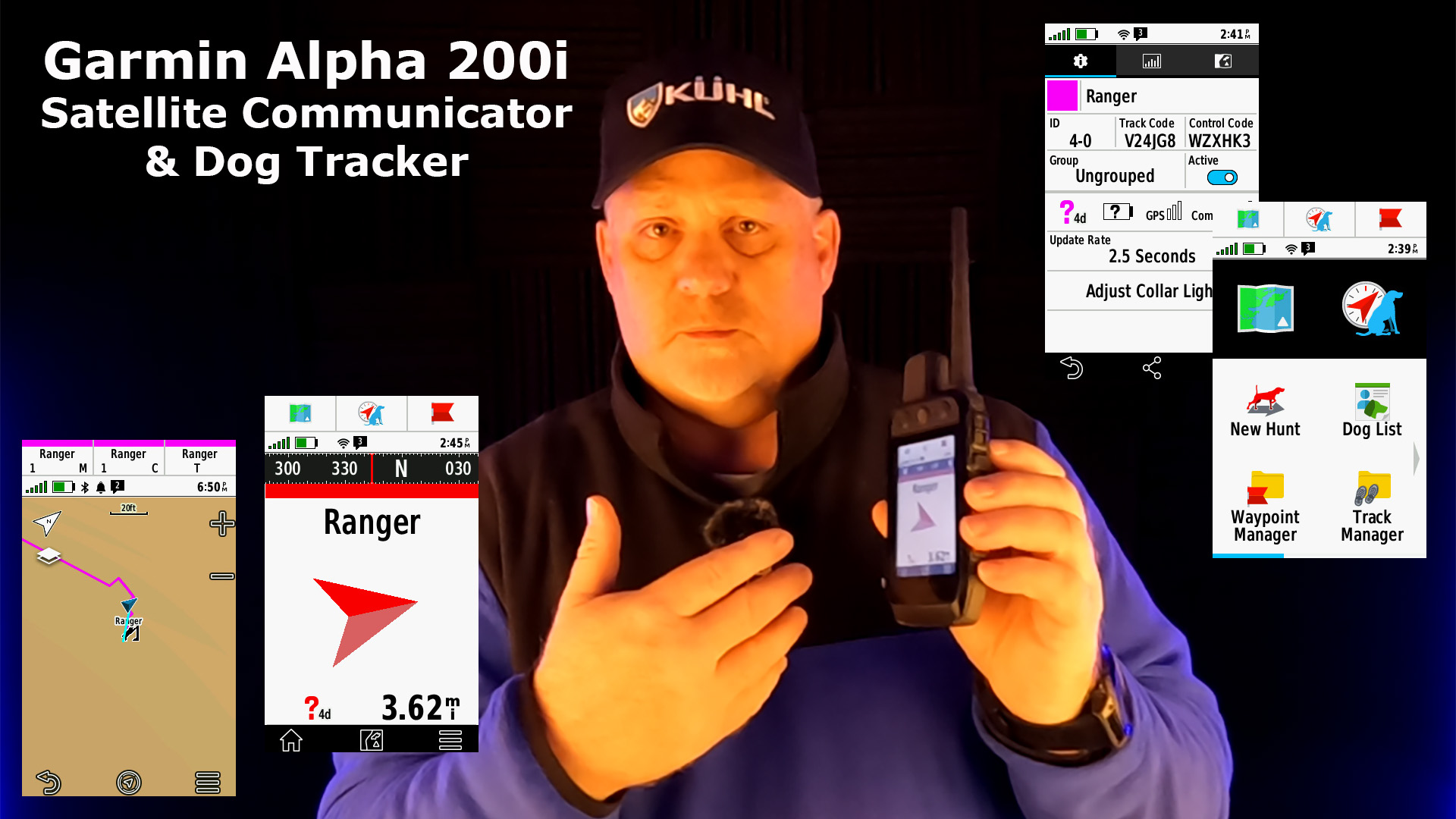
Check out the Garmin Alpha 200i Dog Settings that will help you customize everything for each dog, and up to 20 dogs.
Customize Settings for Each Dog
It will take a little time to customize your settings for your dog(2) but it’s worth the time to set this all up.
First, select DOG LIST to open up the settings menu.

In this menu, you can change the Dog NAME, COLOR associated with your dog, the GROUP, UPDATE RATE, COLLAR LIGHT and more.

![]()
Track Your Dogs
Now it’s time to see what your dog tracks look like on the map.
![]()
Now, you can also select two icons at the top of the home page that will show more information on where your dog is.
![]()
There are a lot of things you can change here to make your life easier, and you should take some time to set this up for you and your dogs.
You can learn more about the Garmin Alpha 200i Field Test HERE.
Final Thoughts
It’s great to have a Garmin inReach satellite communicator where you can also track your dogs. I have only begun to test the Alpha 200i but already am impressed with what it looks very capable of doing.
Check out this YouTube video to learn more about how to customize the settings.
- Features sunlight-readable 3.5” capacitive touchscreen display and a button-operated, dog-focused design for quick, minor adjustments
- Easily set up and monitor up to 20 dogs from up to 9 miles away with a 2.5-second update rate by using multiple global navigation satellite systems (GPS and Galileo)
- Dog list and group management lets you keep inactive dogs in the system for easier setup
- Interactive SOS alerts and two-way messaging via the 100% global Iridium satellite network (active satellite subscription required; jurisdiction restrictions may apply)
- Preloaded TopoActive maps, direct-to-device BirdsEye Satellite Imagery downloads and built-in three-axis compass and barometric altimeter
- User-replaceable battery lasts up to 20 hours; up to 15 hours with inReach technology enabled
This product was presentation was made with AAWP plugin.
![]()
Return to Home Page