Here’s my Garmin GPSMAP 67i Review and 2nd Field Test.
GPSMAP 67i Features
- All-in-One Device
- SOS
- Two-way Messaging
- Location Share
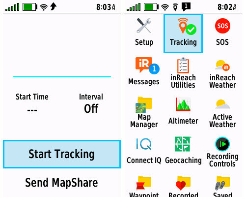
- Tracking
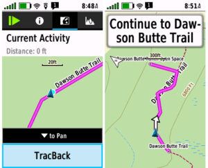
- TracBack
- Pre-loaded Topo Maps
- Satellite Imagery
- Course Creation
- Navigation
- Weather Forecasts
- Active Weather
- Multi-band Technology
- ABC Sensors (Altimeter, Barometer, and Electronic Compass)
- Outdoor Maps+ with Public / Private Land Boundaries
- Great Battery Life
- Global Satellite Coverage
- Explore App
- Messenger App with Group Chat
- Geocaching
- Customizable Menus
2nd Field Test
First, I always start out by turning tracking on.
Second, create a course and start navigating.

Third, near the end of my hike I selected TRACBACK, and found my way back to the starting point.
Fourth, send a message letting my family know I’ll be late. This gives them a heads up on my situation and helps them to relax a little.

Lastly, stop tracking and go home and sit by the fire.

Final Thoughts
The Garmin GPSMAP 67i is really one of the top satellite messengers on the market in 2023 and it, along with the Garmin inReach Mini 2 are my two favorite satellite communicators I carry with me on my outdoor adventures.
Check out this YouTube video below of my 2nd Field Test of the GPSMAP 67i.
inReach Mini 2 Tutorial – All You Need to Know
No products found.
No products found.
![]()
Return to Home Page