Here’s a quick video about the Garmin GPSMAP 67i Navigation and TracBack.

Problems on this Field Test
I first noticed an issue with not getting course alerts on the Garmin GPSMAP 67i on several field tests over the past week. I had several subscribers give me a heads up that the setting is in the Marine Page in the Setup Menu.

Follow the steps in the image above and set the miles to 0.01, which turns out to be approximately 53 feet.
Create Your Patch in Course Planner
Next, I created a course in the Explore App. You can follow the steps in the images below.


The Off-Course Alerts Did Not Work When Navigating.
I need to talk with Garmin more to find out if the GPSMAP 67i will give Off and On-Course alerts when navigating. I did not get any course alerts during this navigation test.
The Support.Garmin site does say that you should get Off-Course alerts when navigating, so I will test this more to see if it actually works for me. You can see the information below from Garmin.

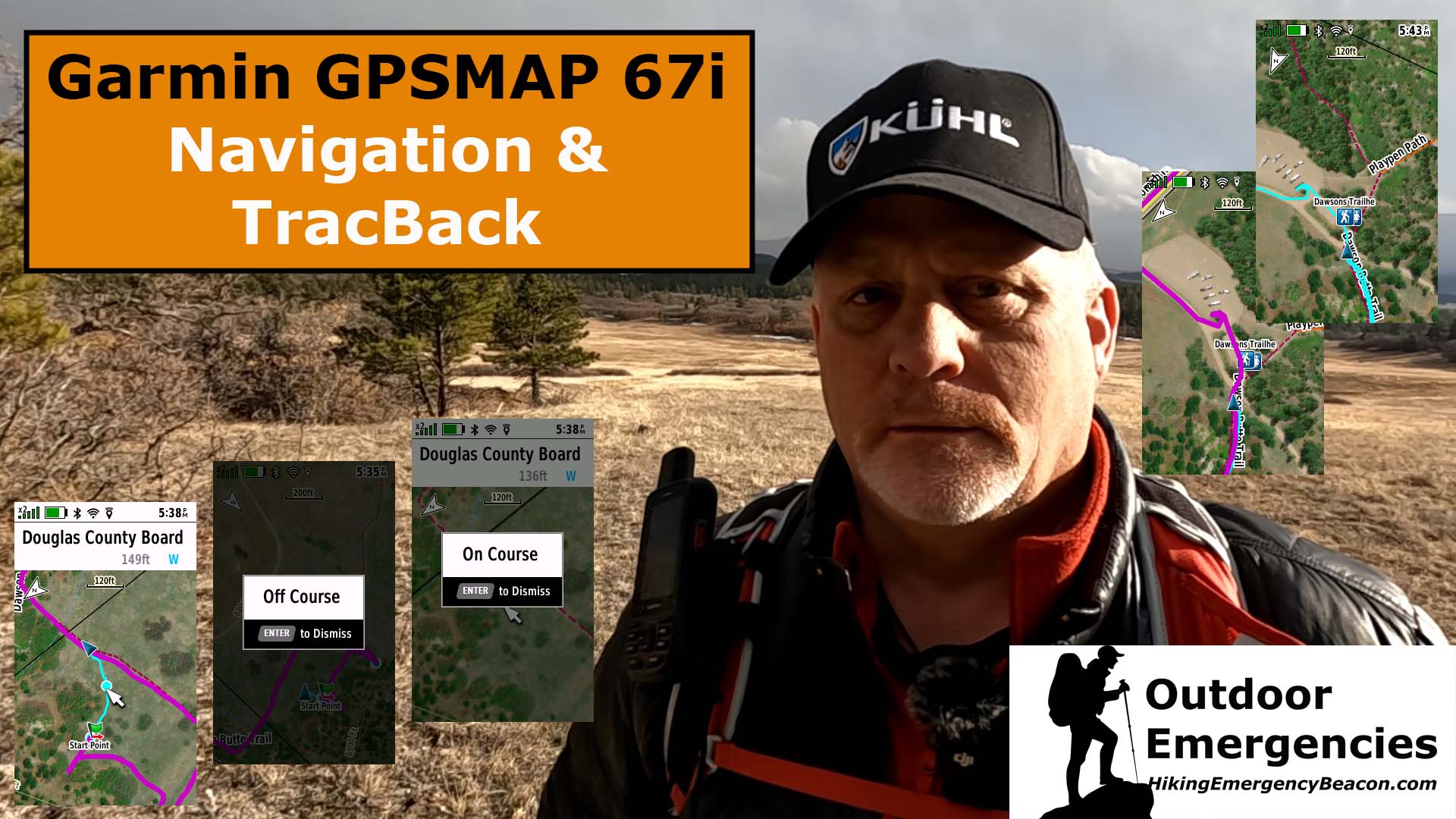
TracBack & Course Alerts
The next test was to TracBack and see if I would get course alerts with that. First, select RECORDING CONTROLS, then select TRACBACK under the map menu withing Recording Controls.

You can see in this case, when using TracBack, I did get a VISUAL and AUDIBLE alert I was on or off course.

Final Thoughts
I will be testing the navigation out more in the near future to see if the course alerts work while navigating. You can see from the above images that course alerts did work during TracBack.
Check out the YouTube video below of the field test for more information.
No products found.
No products found.
Return to Home Page
![]()