Garmin GPSMAP 67i vs Montana 700i / 750i

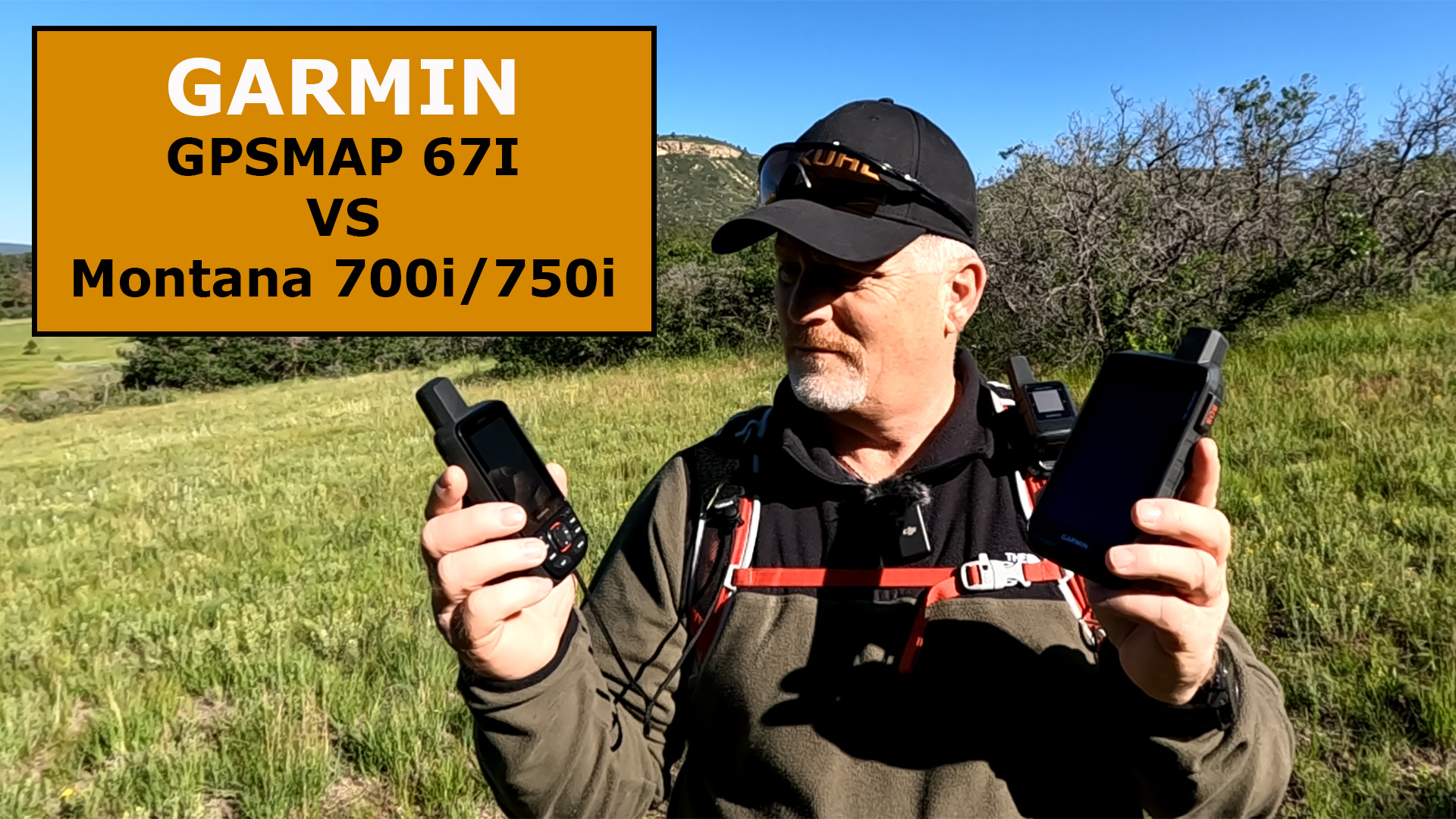
What are the differences between the Garmin GPSMAP 67i vs Montana 700i / 750i?

Garmin GPSMAP 67i

Garmin Montana 700i

How are They Similar?

Garmin GPSMAP 67i

  • Garmin inReach Technology
  • S.O.S.
  • Two-way Messaging
  • Navigation
  • Weather Forecasts
  • Global Pole-to-Pole Satellite Service
  • Sync with Smartphone
  • Flexible Subscription Plans
  • TracBack
  • Rugged Construction

How are They Different?

GPSMAP 67iGarmin Montana 700i

  • Smaller
  • Built for Hikers & Backpackers

Montana 700i/750i

  • Larger
  • Touch Screen
  • Built to Mount on an ATV, Jeep, etc.
  • City Navigator (Available to Download)
  • BaseCamp (Available to Download)

Who are They Meant For?

These two satellite communicators are both made by Garmin and both have the inReach technology that allows you trigger an S.O.S. message and text two-way with friends and family.

The primary difference is the GPSMAP 67i is smaller and designed to carry on a backpack. It also has a much longer battery life than the Montana 700i.

The Montana 700i/750i is designed to mount on a Motorcycle, ATV, Jeep, Truck, etc., and be charging while using so you don’t run out of battery. It has a much larger screen and it is touch screen, so it is easier to use in or on a vehicle.

Garmin GPSMAP 67i

Final Thoughts

Let’s keep this simple. After using both of these and talking to garmin, they are two of the most powerful satellite communicators on the market. Chose the GPSMAP 67i if you are primarily carrying it on your backpack. Chose the Montana 700i if you are primarily using it on something like an ATV or jeep.

Check out this Field Test between the two devices to learn more.

Garmin GPSMAP 67i Rugged GPS Handheld with inReach® Satellite Technology, Two-Way Messaging, Interactive SOS, Mapping
  • Large 3” sunlight-readable color display for easy viewing
  • Enable two-way messaging and location tracking via the 100% global Iridium satellite network, and trigger an interactive SOS to Garmin Response℠, a 24/7 staffed emergency response coordination center (active subscription required; some jurisdictions regulate or prohibit the use of satellite communications devices)
  • Access preloaded TopoActive mapping from Garmin, view satellite imagery, and navigate with multi-band GNSS support and sensors
  • When paired with your compatible smartphone, you can access active weather forecasts and Geocaching Live
  • Use with the Garmin Explore website or app on your compatible smartphone to help you plan trips and more
  • Get access to a wide variety of premium mapping content delivered directly to your device via Wi-Fi technology with an Outdoor Maps+ subscription

This product was presentation was made with AAWP plugin.

Sale
Garmin Montana 700i, Rugged GPS Handheld with Built-in inReach Satellite Technology, Glove-Friendly 5" Color Touchscreen
  • Features rugged military-grade construction and a 5” touchscreen display that’s 50% larger than the previous model; offers easy viewability and includes versatile mounting solutions.Control Method:Touch,Application.Special Feature:Routable Topo Maps; Multiple GNSS Networks, ABC Sensors; inReach Satellite Communication; BirdsEye Satellite Imagery.
  • Trigger an interactive SOS to the GEOS 24/7 monitoring center — two-way messaging via the 100% global Iridium satellite network (active satellite subscription required; some jurisdictions regulate or prohibit the use of satellite communications devices).
  • Multi-GNSS (GPS and Galileo) support — plus preloaded TopoActive maps and City Navigator street map navigation; navigation sensors include 3-axis compass and barometric altimeter
  • Pro-connected with ANT+ technology, Wi-Fi connectivity and BLUETOOTH wireless networking, giving you direct-to-device access to BirdsEye Satellite Imagery downloads, location sharing, Connect IQ app support and more
  • Compatible with the Garmin Explore website and app to help you manage waypoints, routes, activities and collections, use tracks and review trip data from the field

This product was presentation was made with AAWP plugin.

Sale
Garmin inReach Mini 2, Lightweight and Compact Satellite Communicator, Hiking Handheld, Orange - 010-02602-00
  • Compact, lightweight satellite communicator enables two-way messaging and interactive SOS globally (Active satellite subscription required. Some jurisdictions regulate or prohibit the use of satellite communication devices.).Special Feature:Bluetooth.Water Resistant: Yes
  • Navigate back to where you started by using TracBack routing
  • Share your location with loved ones back home at any time (active satellite subscription required) by using your MapShare page or with your coordinates embedded in your messages
  • Get accurate heading information using the digital compass — even when you’re not moving
  • Sync with the Garmin Explore app and website on your compatible smartphone for trip planning and topographical mapping, and create waypoints, courses, activities and collections you can sync to your device
  • Pair with Garmin devices, such as wearables and handhelds, and use them to send and receive messages and trigger an SOS (active satellite subscription required)

This product was presentation was made with AAWP plugin.

Sale
Garmin Backpack Tether Accessory for Garmin Devices, Black
  • Compatible with multiple Oregon, Alpha, inReach, GPSMAP, and eTrex devices.
  • Durable nylon harness wrap
  • 2-Inch - 14-Inch adjustable strap

This product was presentation was made with AAWP plugin.

support-hiking-emergency-beacon

Return to Home Page

Leave a Comment