Here’s a quick look at the Garmin inReach Mini 2 Marine Weather Forecasts.

Types of Weather Forecasts & Costs
- Basic – Counts as 1 Message
- Extended – $1.00 per Request
- Marine + Basic – $1.00 per Request
- Marine + Extended – $2.00 per Request
On-land Weather Forecasts
The Basic weather forecast includes up to 4 days of weather and gives forecasts every 2 hours for 36 hours.
The Extended weather forecast includes up to 8 days of weather, 2 hour intervals for the first day, 3 to 6 hour intervals for the second day, and 12 hour intervals for the remaining 5 days.
Note: 1 to 2 hour intervals are only available in the U.S.
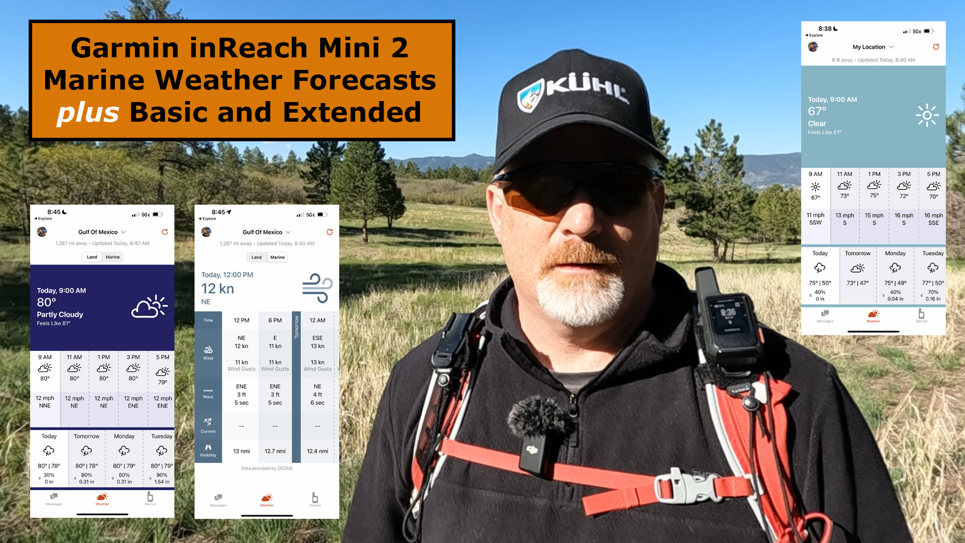
Here is an example of an Extended Weather Forecast.

Marine Weather Forecasts
The Marine weather includes a 6 to 7 day forecasts with 4 six hour intervals each day, plus it provides wave height, ocean current, and visibility details.
Here is an example of a Marine Weather Forecast.

Final Thoughts
The weather forecasts can be extremely helpful when out on an adventure, even though the forecasts may not have an incredible amount of detail.
I recommend always starting with the BASIC weather forecast and then only request the EXTENDED or MARINE + EXTENDED if you need additional information.
You can learn more about the weather forecasts at Garmin by clicking HERE.
Check out this YouTube video below of the weather field test.
No products found.
![]()
Return to Home Page