Trail Information
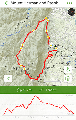 Trail Name: Mount Herman and Raspberry Mountain Loop
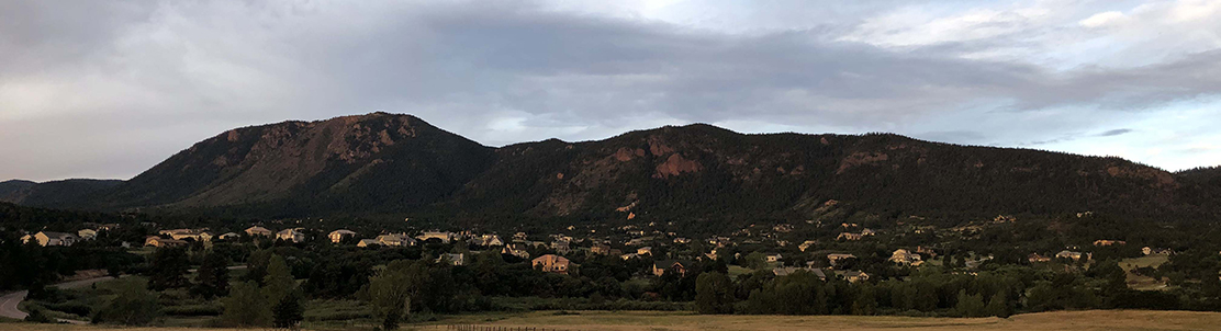
Location: Near Palmer Lake and Monument, Colorado
Date: September 7, 2019
Time at the Trail Head: 7:00am
Trail Length: 9.3 miles
Elevation Gain: 1,929 feet
Elev. at Trail Head: 7,293 feet
# of Hikers Passed: 19
# of Mnt. Bikers Passed: 13
# of Horses Passed: 0
Mosquitoes: 0

My Day on the Trail
I decided to look for a hiking trail between Denver and Colorado Springs with a decent length and moderate rated trail. I finally settled on the Mount Herman and Raspberry Mountain Loop trail that sits in between Lake Palmer and Monument, just north of Colorado Springs.
The trail started out (clockwise) and was a little disappointing. The weather was great and it was about 65 deg. F when I started off but the hillside had been decimated by a fire in the summer of 2011.
Click HERE to see a short video of the fire from Monument. The hillside has grown back with a lot of scrub oak and the trail is not well maintained. This part of the trail was difficult to stay on as it is not well traveled these days.
I lost the trail several times and had to walk up the gravel road for at least a half mile until I could find the trail again. Most people take a short trail to the gravel road and walk up the road for about a mile before reaching the well maintained trail. I also had to do this and it is annoying to be passed by about 20 vehicles when you’re expecting to be on a beautiful trail in the Rockies.
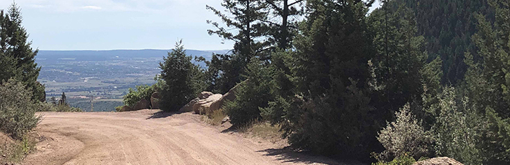
I finally found the main trail and things started looking up after that. This part of the trail is well maintained and it is moderately traveled. I passed about 19 hikers and 13 mountain bikers over the 9.3 miles and that is pretty light for that distance. It probably helped that I was out early in the day and in September when everyone has left the state due to the kids all needing to be back in school.

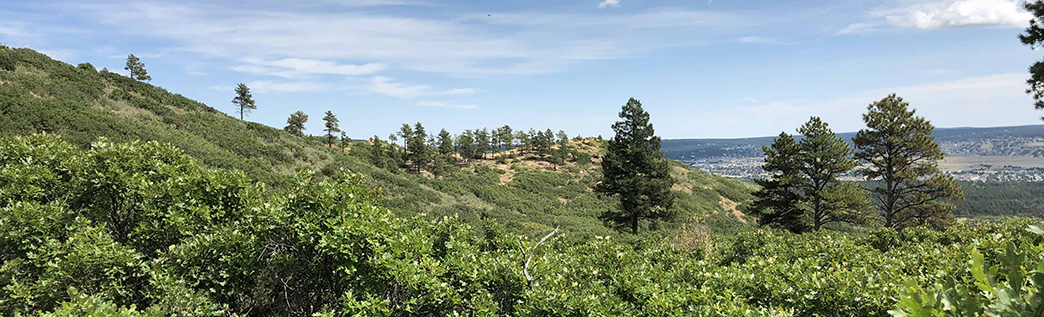
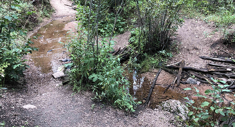
This section of the trail is on the back side of Mount Herman (west side of the mountain) and is the most difficult part of the hike (considering elevation change). It is actually a beautiful hike even though there were not as many places I could see long distances for some great photos. I was in the woods for a majority of the hike. There was a small creek that parallels the trail heading to the north but it wasn’t flowing full and it was easy to cross the few stream crossings I came across.
This part of the trail saw the least amount of traffic and there were several times that an hour or so went by and I hadn’t seen anyone. I don’t mind hiking alone, especially when there are some hikers around and that brought me back to my research that I have done lately on Hiking Emergency Beacons, which are called Personal Locator Beacons (PLBs) and Satellite Messengers. It was on this back stretch that I was thinking it would have been a great idea to have an emergency locator with me. I have heard to many stories, some including experienced hikers, that have ended up in tragedy and may have ended up different if there was a way to call for help.
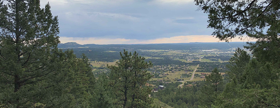
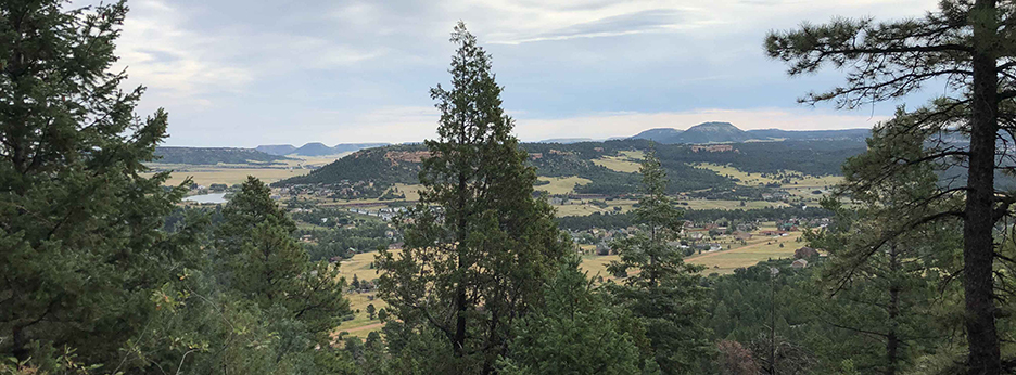
I finally made it around to the north side and then started heading back to the south. This area had some beautiful views but they were of the east side of Mount Herman which is looking out over Lake Palmer, Monument and I-25 in the distance, so it’s not as beautiful as I would like.
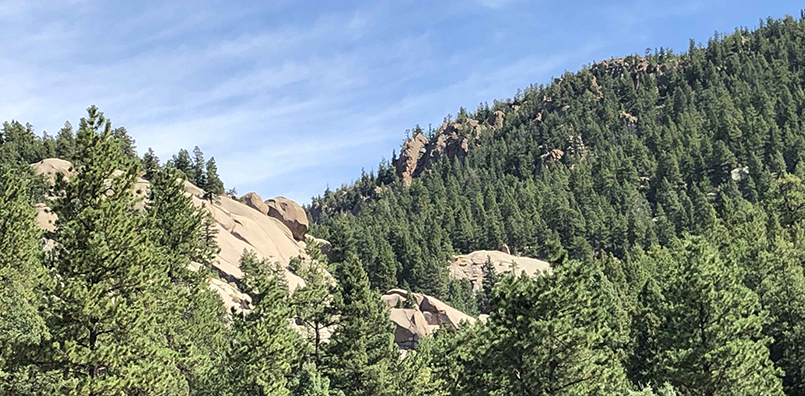
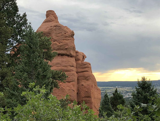
There were a few spectacular photos of rock out croppings along the way.
Trail Recommendations
 One thing that is always great about hiking in the Rocky Mountains is that there is rarely a bad trail and hardly ever a bad day when you get to spend time outdoors. There were many times on this hike where I just stopped and breathed in deeply, that fresh pine scented mountain air. That is just something I will never get tired of.
My recommendation is that you should go ahead and hike this trail if you’re in the area. It is easily accessible from Colorado Springs and it’s not a hard hike, if you’re used to the altitude.
Would I recommend this trail to others? Yes, but will I ever go back to this trail? No. There are so many other incredible trails in Colorado that I have not hiked yet and this one does not rank up their high enough for me to want to revisit.
If you would like additional information or to see the Personal Locator Beacons (PLBs) and Satellite Messengers, go to my REVIEW PAGE, leave a COMMENT BELOW or send me an EMAIL.
Check out my Top 11 Satellite Messengers of 2023 in this YouTube video below.
Return to Home Page
![]()
Mount Herman Loop
Free
Pros
- Easy Access
- Easy to Moderate Trail
- Nice Scenery
Cons
- Difficult to Find Trail at Times
- No Significant Mountain Views
- Not Much of a Stream
- Hike on Gravel Rd for 1/2 Mile
I have never read a website on hiking or hiking trails, which is not surprising since I rarely hike. Not seriously anyway. The scenery, both in the pictures and in your written text sounds pretty nice in spite of the fire damaged areas. am almost 67, have stage 4 cancer, but I can get around without any major problems. Would this trail be hikeable by someone like me?
I am glad to hear that you are staying active and seem to have a great attitude. Your question is a great one and one I will try to answer but may not be able to completely do so since I don’t know exactly what physical shape you are in for the mountains.
First off, the trail starts at over 7,000 feet in elevation so you need to be ready for the altitude. The loop is at least 9.3 miles long but it felt more like 11 miles. There are a lot of shorter trails around the area that are connected to this one and one of the trails is not to long but goes to the top of Mount Herman.
I would recommend you take one of the shorter trails to start and see how you handle the trail and the altitude and then go from there. I have been hiking here for six weeks now and have been on trails from 3 miles long to over 9 miles from an elevation of 6,000 feet to over 10,000 feet in elevation.
I have lived in Oklahoma for 30 years and it took me about 2 weeks to feel like I was pretty well acclimated.
I hope this helps and I look forward to hearing about a trail you do get to if you will come back and share your experiences here with me.
Rick
This is so great! Reading through, one almost gets the feeling of being there.The adventure thrill is palpable, and this is credit to your writing style, kudos to you on that. Adventure is quite beneficial because of the excitement that this adds to life. Nature is very inspirational and helps give a bright view on one’s perspective on life.
Thank you for the compliment. I absolutely love the outdoors and especially the mountains. I never get tired of smelling the fir or pine trees when I am around them.
I’m not sure how much I will write about my hiking adventures but I do enjoy writing about them and I always come back with new stories and things I have learned along the way.
Thank you for stopping by and commenting.
Rick